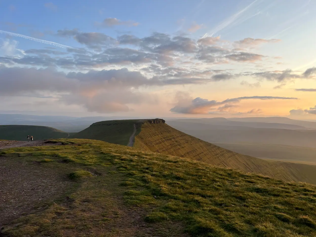

Not in Eryri. Pen y Fan is in Bannau Brycheiniog (Brecon Beacons), south Wales (National Park Authority). The National Trust looks after the mountain and car park.
Pen y Fan at a glance
The National Trust circular from Pont ar Daf: up to Pen y Fan, the highest point in southern Britain, then Corn Du and back.
- Start: Pont ar DafA470, 8 miles south of Brecon (National Trust)
- OS Explorer OL12National Trust route guide
The route
- Pont ar Daf car parkFootbridge over the river
- Bwlch Duwynt"Windy Pass", stone-pitched path
- The saddleViews down the Neuadd valley
- Pen y Fan886 m, highest in southern Britain
- Corn DuBronze Age cairn
- Tommy Jones' obeliskDown to the Blaen Taf Fawr stream
- Y Gyrn and Storey ArmsBack to the car park
Parking and getting there
Pont ar Daf car park (National Trust)
£7.50 a car, all day£10 motorhome or minibus£12 coach
National Trust parking page · JustPark location code 80651 (car)
Cwm Gwdi car park (National Trust)
£4 a car£8 motorhome or minibus
National Trust parking page · JustPark location code 80556 (car)
- LD3 8NLA470, near Storey Arms
- T4 and T14 busesTo Storey Arms, by the start
- JustPark app or machinesNo overnight parking
- Free for someNational Trust members, blue badges, motorbikes
Spaces are limited: the National Trust asks you to use public transport where you can.
Plan your Pen y Fan day
1. Pick a day
Loading the live forecast…
Forecast loading…
Best day this week
Our own guide, not an official rating: a weather score from the same rules of thumb as the warnings (gusts, rain, cloud, wind chill, freezing level), lowered on days that are usually busy. Busyness uses Eryri's 2025 walker counts by weekday and month, so it shows a typical pattern, not a crowd forecast. Tap a day to see it.
Sunrise hike: what time to start
- You will walk up in the dark: carry a head torch with spare batteries, and a second light. Eryri advises carrying a torch and whistle in case you are caught on a summit after dark.
- It is much colder before dawn and at the top: pack extra warm layers.
- Navigation is harder in the dark: know the path, and carry a map and compass and the skills to use them.
- Early buses may not run yet: check the first bus time, or the parking rules, before you plan the start.
- Go with others, tell someone your plan, and turn back if the weather is poor.
Hour-by-hour forecast: Pen y Fan summit (886 m)
Wind and gusts in mph. Freezing level in metres above sea level. Forecast data: Open-Meteo.
Before you go, also check the Met Office mountain forecast, MWIS.
2. Getting there
Map
The route map (OpenTopoMap) loads when you scroll here.
How busy it gets
Before you go
- Uneven pathsStone-pitched, with gates and stiles
- Dogs on a close leadSheep graze here
- Mountain forecastMet Office and MWIS
- Emergency: 999 or 112Police, then Mountain Rescue
Photos
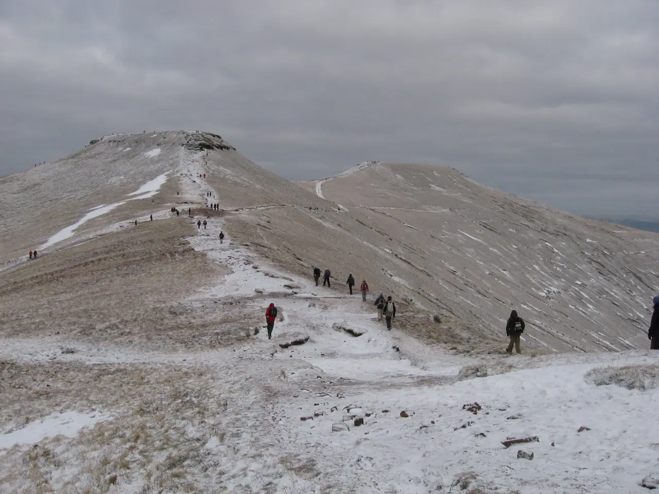

Photos: Wikimedia Commons. Click a credit to see the original and its licence.
Mountains in Eryri
The six paths up Yr WyddfaGlyder FawrTryfanCadair IdrisCompare Eryri walks
Frequently asked questions
Is Pen y Fan in Snowdonia?
No. Pen y Fan is in Bannau Brycheiniog (the Brecon Beacons National Park) in south Wales, not in Eryri (Snowdonia). It is the highest mountain in southern Britain.
How long does it take to climb Pen y Fan?
The National Trust's Pen y Fan and Corn Du circular from Pont ar Daf is 4 miles (6.4 km) and takes about 3 hours 30 minutes.
How high is Pen y Fan?
886 m (2,906 ft), according to the National Trust.
Where do you park for Pen y Fan?
Pont ar Daf car park on the A470 (LD3 8NL), run by the National Trust: £7.50 a car for the day. Members, blue badge holders and motorbikes park free. Spaces are limited; the Cwm Gwdi car park is the other National Trust option.
Is there a bus to Pen y Fan?
Yes. The National Trust says the T4 and T14 buses run from Merthyr Tydfil or Brecon to Storey Arms, next to the start.
Can I take my dog up Pen y Fan?
Yes, on a close lead. The National Trust asks you to keep dogs on short leads near grazing livestock.
Sources
- National Trust: Pen y Fan and Corn Du circular walk
- National Trust: Bannau Brycheiniog (parking, buses, facilities)
- Bannau Brycheiniog National Park Authority
- Met Office mountain forecast: Brecon Beacons
- MWIS: Brecon Beacons National Park
- Ordnance Survey: Explorer OL12
- OpenStreetMap: Pen y Fan and Corn Du circular (relation 19690615, ODbL)
- OpenTopoMap (map tiles, CC-BY-SA)
Every figure on this page was checked against these sources on 20 October 2026. Walker counts: there is no Eryri-style counter data for Pen y Fan, so the planner ranks days by weather only.